The Thames Trot Per Åström

Current progress

Per Åström has already done 138.9 km

Latest activity on the course at 17:01, Thursday, 29 October.
Current weather: Overcast clouds and 14.1°C. Wind 8.2 m/s from SSW
Follow Per Åström on Strava.

Share
Share the progress on Facebook.

Days until challenge ends 1274.
Keep up the good work. You are 154 km from reaching Thames Barriers in East London.
Percent done: 47%. Currently you average 1 km/day. At this pace you'll be done in 154 days on Friday, 27 September.
You need to average 0.1 km/day to reach goal before Saturday, 31 October.

Jeroen Wolfers is 7.1 km behind. Måns Renntun is 5.8 km ahead.

Points of interest

Pangbourne College Boat Club

Pangbourne College Boat Club is a rowing club based on the River Thames at Pangbourne College Boathouse, Shooters Hill, Pangbourne, Berkshire. == History == The boat club is owned by Pangbourne College with rowing being a major school sport.The club is a leading school rowing club and has won the prestigious Princess Elizabeth Challenge Cup at the Henley Royal Regatta on four occasions and has also won the Queen Mother Challenge Cup at the National Schools' Regatta.

Photo: Chuckplatypus (CC BY-SA 3.0)
Read more: Pangbourne College Boat Club
Whitchurch Bridge

Whitchurch Bridge is a toll road bridge over the River Thames in England. It carries the road between the villages of Pangbourne, Berkshire, and Whitchurch-on-Thames, Oxfordshire, and crosses the river on the reach above Mapledurham Lock, just before Whitchurch Lock. The bridge has a weight limit of 7.5 tonnes and is a Grade II listed building.Whitchurch Bridge is one of two remaining private toll bridges across the River Thames (the other being Swinford Toll Bridge), being owned and maintained by The Company of Proprietors of Whitchurch Bridge entirely from toll receipts. Tolls currently range from 60p for cars to £4 for vehicles of over 3.5 tonnes. The Thames Path crosses the river on this bridge, but there is no charge for pedestrians, cyclists or motorcycles.

Photo: Graham Horn (CC BY-SA 2.0)
Read more: Whitchurch Bridge
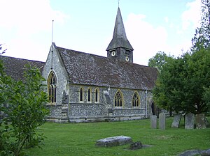
Whitchurch-on-Thames

Whitchurch-on-Thames is a village and civil parish on the Oxfordshire bank of the River Thames, about 5.5 miles (9 km) northwest of Reading, Berkshire, in close proximity to Whitchurch Hill. Opposite Whitchurch on the Berkshire bank is the village of Pangbourne. == History == The Church of England parish church of Saint Mary was originally Norman, and was altered in the 15th century. In 1858 the Gothic Revival architect Henry Woodyer completely rebuilt the church, retaining only the Norman south door, Perpendicular Gothic south porch and a few other items. The parish is now a member of the Langtree Team Ministry: a Church of England benefice that includes also the parishes of Checkendon, Ipsden, North Stoke, Stoke Row and Woodcote.Since the 16th century Whitchurch has had a weir and flash lock on the Thames to manage water levels for navigation.

Photo: Sealman at English Wikipedia (Public domain)
Read more: Whitchurch-on-Thames
Whitchurch Lock

Whitchurch Lock is a lock and weir situated on the River Thames in England. It is a pound lock, built by the Thames Navigation Commissioners in 1787. It is on an island near the Oxfordshire village of Whitchurch-on-Thames and is inaccessible except by boat. The weir crosses the river to the Berkshire village of Pangbourne . == History == There was a flash lock recorded at Whitchurch in the 16th century.

Photo: Nancy (CC BY-SA 3.0)
Read more: Whitchurch Lock
River Pang

The River Pang is a small chalk stream river in the west of the English county of Berkshire, and a tributary of the River Thames. It runs for approximately 23 kilometres (14 mi) from its source near the village of Compton to its confluence with the Thames in the village of Pangbourne. The river, and its water voles, are thought to have inspired author Kenneth Grahame's character Ratty and his book The Wind in the Willows. == Course == The river's source is normally near the village of Compton, although the exact location varies depending on rainfall levels. In times of high rainfall it can be traced back to Farnborough, some four miles to the west-north-west, whilst at other times it may be as far downstream as the outfall from Hampstead Norreys sewage works.

Photo: Chris j wood (CC BY-SA 4.0)
Read more: River Pang